Thursday, March 5, 2026

Good Times With Raynauds (a tribute)

The climbing community in Missoula is small, and the winter climbing community is even smaller. I think that just about every ice and mixed climber here knows, or knows of one another which is something that makes the climbing community here so special. Jeff was certainly known by just about all of us here and I'm sure he had tied in with just about every one of us too. 

I met Jeff at a time when I was incredibly motivated and eager to start swinging tools. Because of that he had a lot of influence on my perception of ice and mixed climbing and on what someone can be capable of accomplishing in the mountains. 

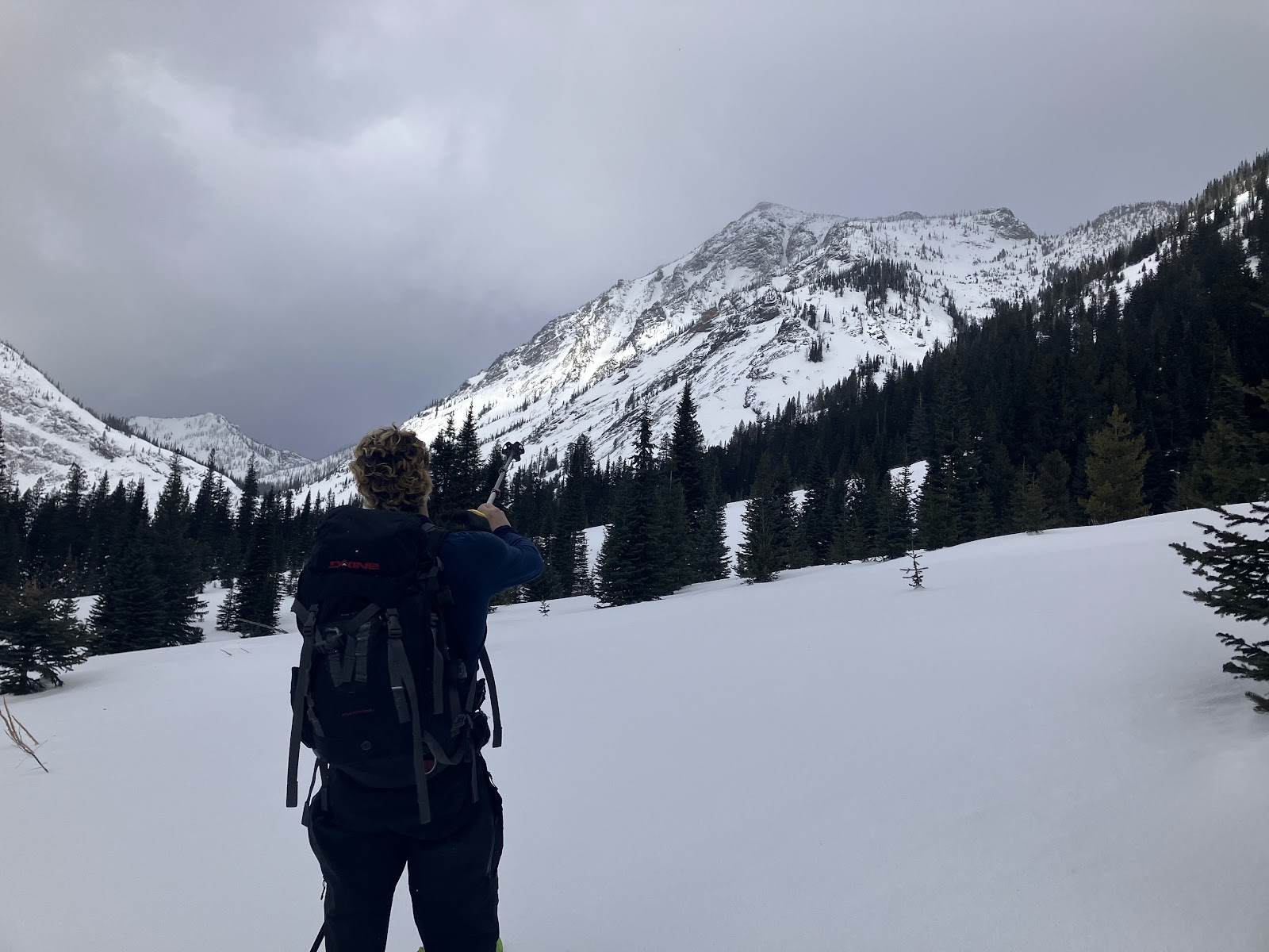
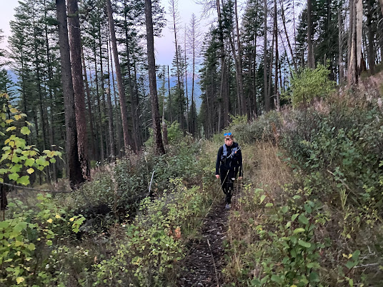
We had started our partnership out by dry tooling at Finley and soon we were skiing in the Missions, searching for ice and dry tooling at his Sleeping Child Crag. Seeing Jeff's drive in our early adventures  had me wondering, what was the extent of his motivation, how far could he push it? 

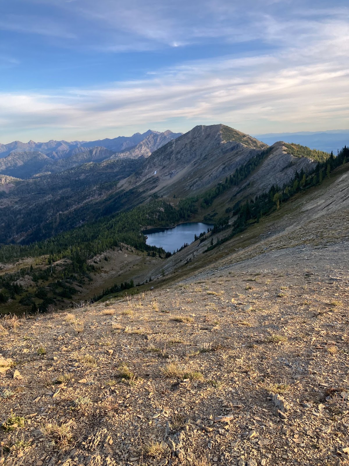
Just last fall, in 2025, Jeff had texted me asking if I was free to climb the north face of Mount Borah in Idaho. I told him I was unable due to work and school, and I assumed that he would bail on going if he couldn't find a partner. Just a few days later I saw on his social media that he had apparently summited Borah and by the looks of it was solo. 

He had gone out there to meet up with an internet climbing partner, however when his partner never showed at the trail head, Jeff decided he would still go for it alone.

A couple weeks passed before one morning he was sitting in the back of my truck as he, our friend Phil and I drove out to Finley for a dry tool session. In the rear view I noticed he was messing around with what looked like bandages and medical supplies. When I turned around to see what he was doing I saw that he was tending to his severely frost bitten toes, the result of a 27 hour push, through a storm, on the north face of Mount Borah. "Jesus dude that looks gnarly, how the hell are are you climbing today?" I asked him in astonishment. "Really they don't hurt that bad" He said to us. 

Really they don't hurt that bad. 

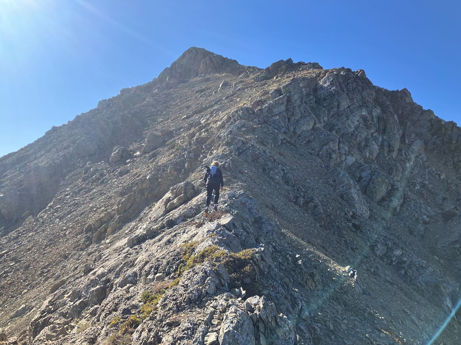
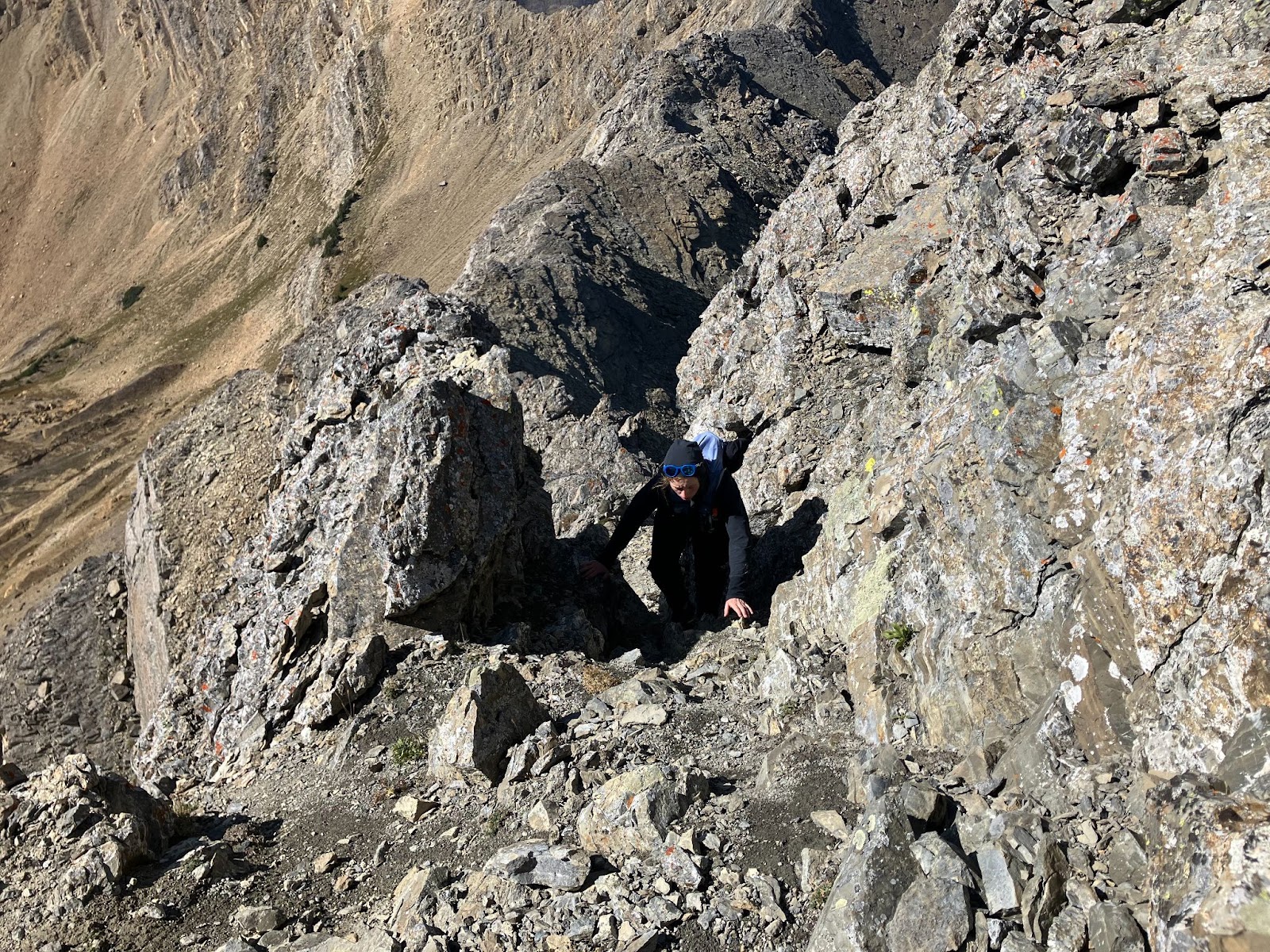
The toes I saw in the back of my truck that day would have had most people benched for months. But not Jeff. He was too eager to go climbing that it surpassed the pain, so eager that the following weekend after his Mount Borah epic, Jeff and his toes chased an opportunity to climb the north face of the Sphinx and successfully topped out. 

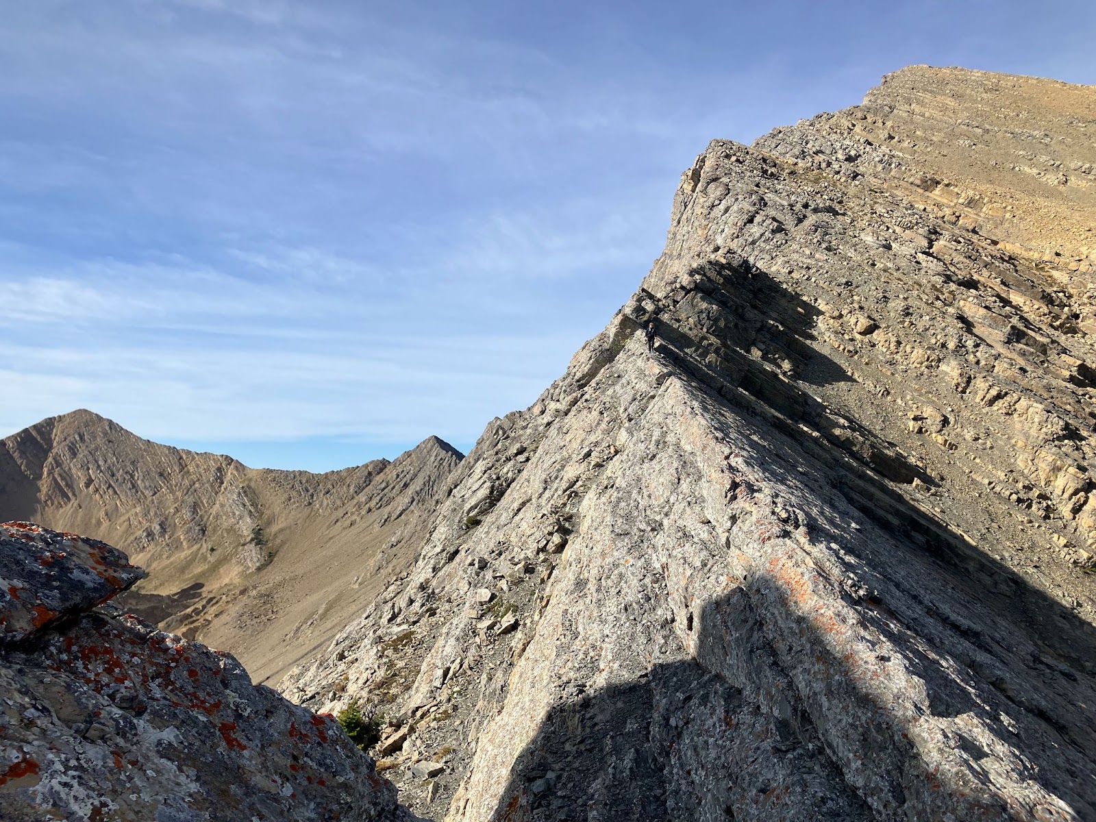
His effort on Borah goes to show the extent of what his mental capabilities in the mountains were and going out to the Sphinx right after highlights his motivation to go climbing. In fact, these traits resonated with that of great alpinists and mountaineers throughout history. To be able to push on for 27 hours takes serious strength. The ability to look through the shit and keep on going is something that not everyone has. When telling us about his Borah trip he said "I got to watch the the sun rise twice."

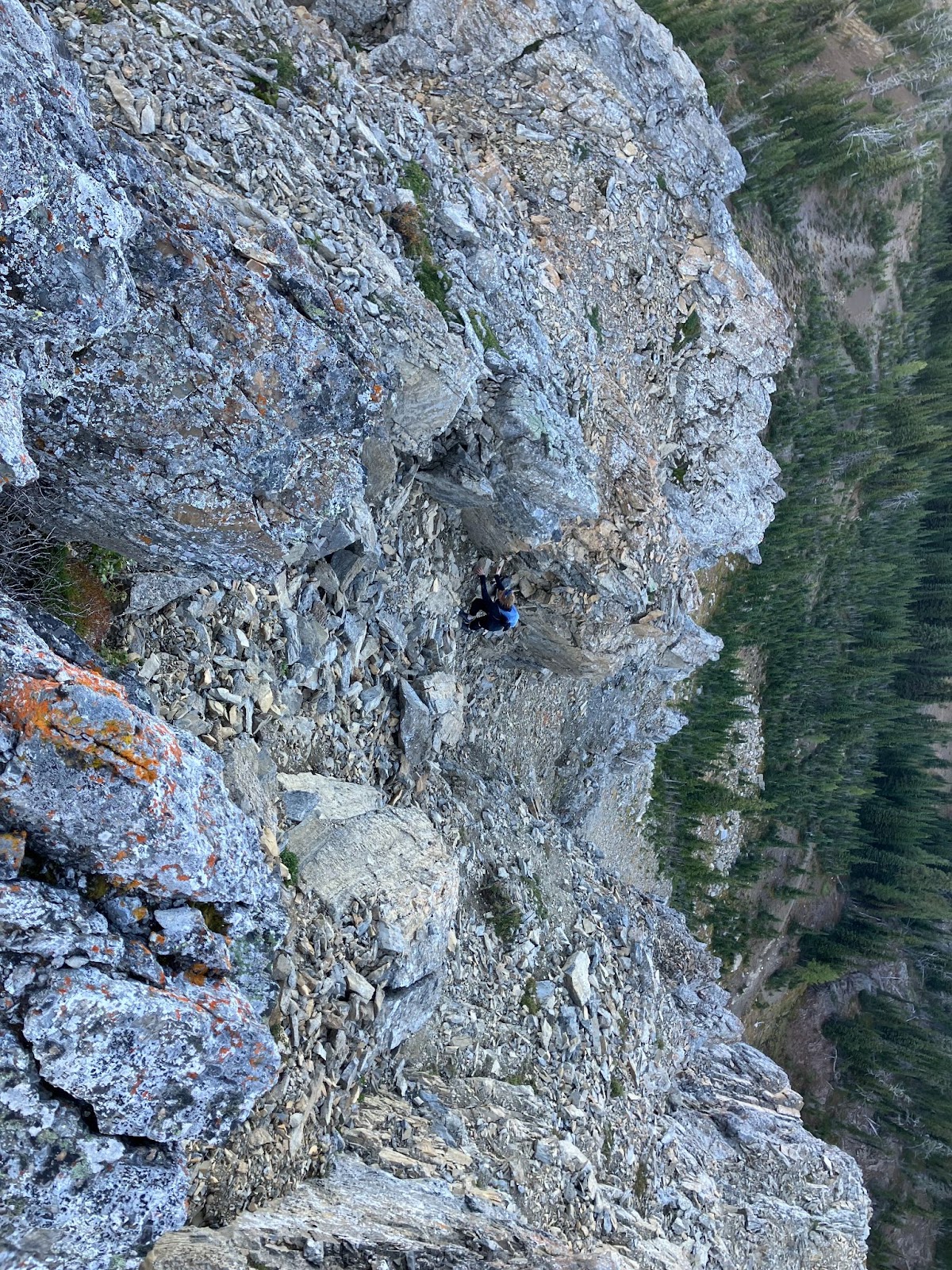
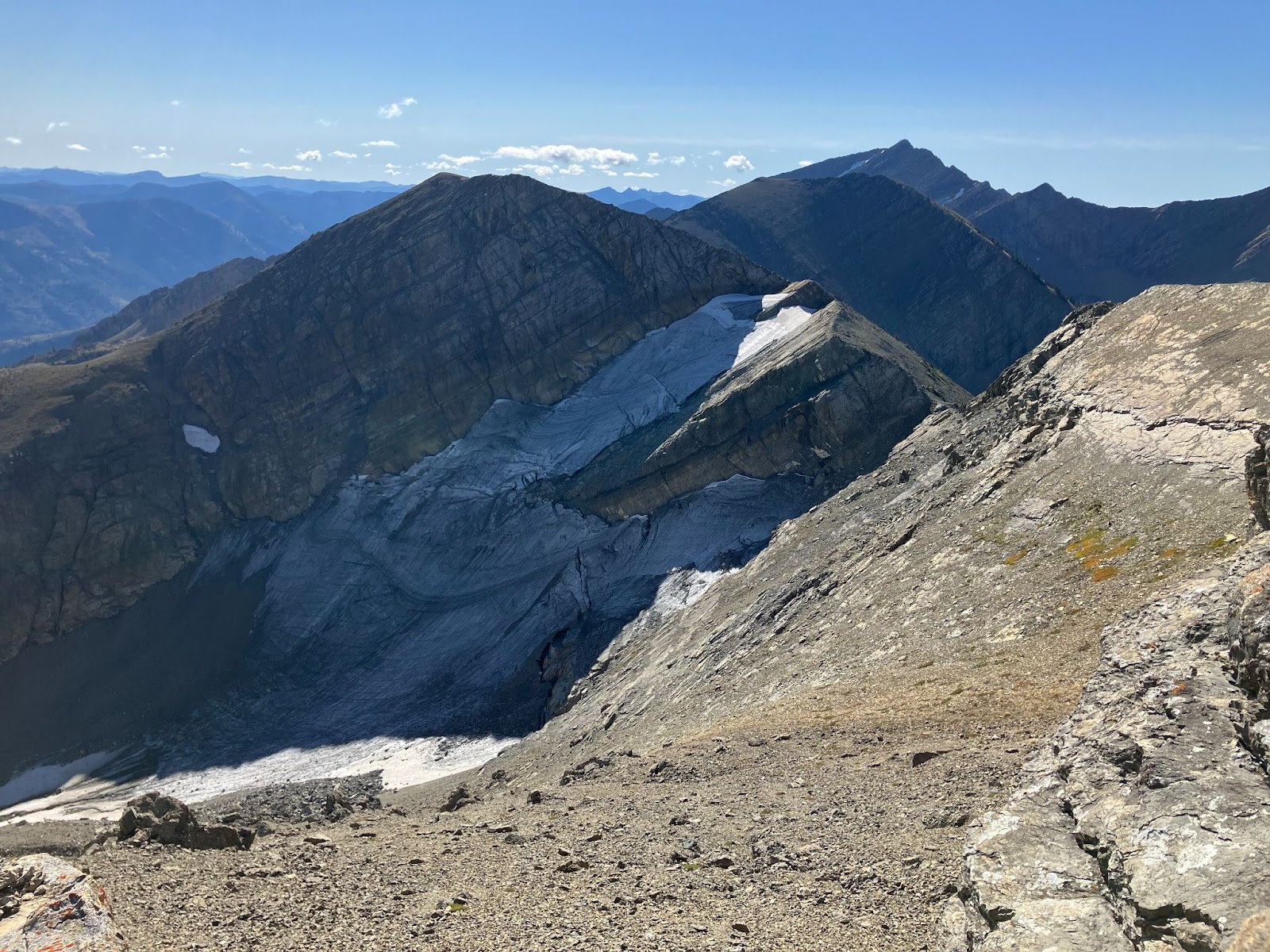
The mental capabilities that Jeff had were certainly a strength of his in the mountains, however they were perhaps a point of weakness as well. In November of 2024, Jeff and I left Missoula at 3 am on a smash and grab trip to the Absorokas, where we intended to climb a route called War Paint.

He was still recovering from an injury he had suffered that summer, something I had not considered when driving out there. He had been recovering from a broken heel and explained to me that his doctor had cleared him to climb. Looking back on that Im assuming that his doctor had probably cleared him to gym climb, or climb somewhere roadside. But his ambition overpowered the pain in his heel and slowly, he limped his way up the trail behind me. In the mountains, Jeff didn't care about time, or about going fast, being out there was all he needed. That day I should have mentioned something about his heel, because moving slow would later come to bite us.

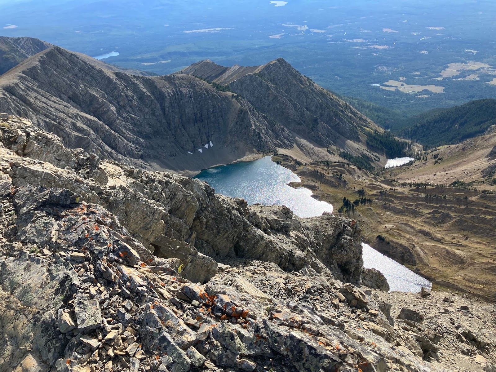
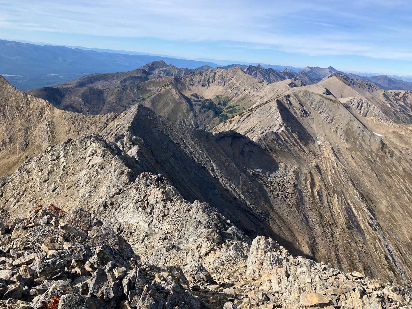
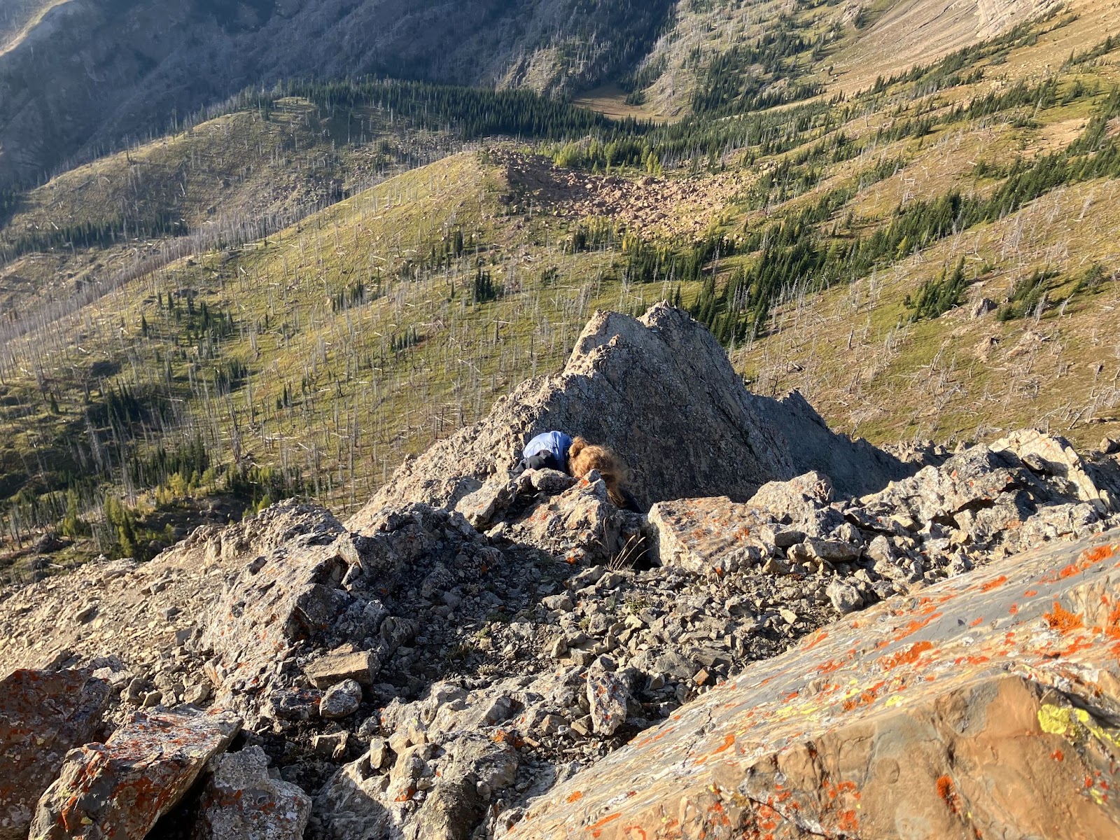
What happened to us that day has been a pivotal point in my climbing as it was the first time I've found myself in a serious situation while in the mountains. We had climbed the route successfully but topped out quite late in the day. As we were setting up a rappel, a storm that we knew was coming hit us hard. Little rollerball's of snow came pouring from the sky and onto the mountain. Wind gusts were blowing up and down the couloir we were standing in and soon snow from the slope above came funneling down onto us. We were in an hourglass, standing right in the pinch.

As a spindrift avalanche began pouring directly onto us we scrambled to retreat off the mountain and due to a broken v-thread tool, we were forced to leave behind several ice screws and a few alpine draws. That day we both made many mistakes. Our weak colors were exposed and we were both forced to work through it to get out of there. 

When I arrived to the anchor after the first rappel  I noticed Jeff visibly shivering. His jacket was covered in frozen water ice and spin drift, icicles formed from his helmet. "How are you doing man?" I asked him. "I'm fine, my hands are just really cold." Jeff suffered from Raynauds, a medical condition that limits blood circulation typically to ones fingers or toes. When I looked at his gloves I noticed that his hands were in fists inside them and each finger on them was either twisted or bent and all were frozen, covered in a thin layer of frost. "Shit dude, you want my extra pair of gloves? I have some in my pocket." "Nah I'm good, lets just get down." he said to me.

Nah I'm good. 

I couldn't believe he said that to me. How was it that he didn't want dry gloves? Was he so fixated on getting down that he was looking beyond the pain in his hands? We had just spent a stress filled hour and a half of spindrift avalanches, botched v-threads, nearly dropped ropes and heavy wind gusts, all with his hands trapped in ice blocks, and now when presented with dry gloves he said he'd be alright without them. I shook my head and pulled out my extra gloves. "Put these on man." 

That day made me reconsider the endeavor of alpine climbing. Seeing how quickly things can get serious made me realize that perhaps I wasn't quite ready to chase objectives like that and that I needed more experience. Jeff however, I don't think was too phased by this day. For him, this epic was just another outing. 

When I got word of Jeffs disappearance, I was told that he was believed to have been somewhere west of Darby. Immeadetly, I thought that he was likely in the Bitterroot, but when I heard his car was found up Sleeping Child Road, I was surprised. For some reason it seemed strange that something could have gone wrong there, but then again accidents often happen in places you feel comfortable, places where you let your guard down. Sleeping Child is a roadside crag where he had been developing rather bold mixed lines on gear and quite often he would go out and top rope solo out there. 

As of right now it is still not totally known what happened to him out there and what went wrong. Its a terribly unfortunate thing that happened and its incredibly sad to lose a partner and member of our small community.

Jeff was wild man who had a deep passion for the mountains. He was bold, and he was more than willing to give a challenge everything he had. Each outing with him was a wild adventure for better or worse and I was fortunate to be able to share some of the best days I've had in the mountains with him. 

Rest easy Jeff


Sunday, November 16, 2025

Mt. Humphreys East Arete


Mt. Humphreys East Artete 

When I drove into the Eastern Sierra for the summer it was from the town of Bishop that I saw Mt. Humphreys for the first time. It stands marvelously high above the valley and is the center of the beautiful sierra skyline that one can see from town.

My goals when I first arrived to Bishop were compromised of moderate alpine routes and multi pitch trad lines around town. I had glanced over Humphreys in my guide book a few times but I think the overall complexity of it deterred me from  even considering to look into it. I even had a climbing partner this summer who had told me about her experience on it. We were sitting on top of Mt. Emerson and she pointed out to me Mt. Humphreys. Its wild and complex south face was looking right at us, and we could even see the east arete slightly. It was like looking at a giant maze and trying to decipher its corridors. It looked big, and it was intimidating. I think what I took away most from her account was "the worst descent I've ever done in my life." 

Cant climb that this summer, I thought. Its initial complexity and size at the root of my negative thoughts. But I kept on looking at it from town, its beauty and proximity, being in the center of the skyline, it called to me like a siren. Something unattainable. I continued to climb around town ticking off easy routes in Pine Creek, and around Bishop Pass. And each night as I laid in bed looking over my guide book to the high Sierra, I kept flipping past Mt. Humphreys, noticing new things about it each time. 

Shortly after climbing Mt. Emerson I flew back to Montana for a week to attend my friends wedding. Some time away from the Sierra brought me back to the life I had felt comfortable living. My same friends, the same mountains. I was at home and it was almost hard to believe that I was even in California prior to this week. But towards the end of my trip, my girlfriend at the time and I broke up and I found myself returning to California with an altered mindset on my life and the purpose of climbing mountains. I questioned what I was even doing in the Sierra in the first place.

The Eastern Sierra desert was hot when I got back, and I spent my free time inside the climbing gym. The gal who I was climbing with prior to going back to MT was in Canada now and I was searching for climbing partners via facebook groups with no luck. 

I was driving back to Big Pine one afternoon when I hit a stop light. From out my windshield Mt. Humphreys was looking down on me, and I was remembering what it looked like from Mt. Emerson. Its wicked tangle of cracks, aretes and ridges all seemed to spiral into a big web in my mind, a door that I was scared to knock on. 

That night I was looking through the guidebook and flipped to that page again. "Mt. Humphreys East Arete 5.5." This time I read the page carefully. A line that caught my attention read, 

"With almost a mile of climbing along an exposed ridge this technically easy route requires great route finding skills and mental focus for an extended period of time."  

When I read this it intrigued me into the route more so than I had felt before, and reading the route topo it all of a sudden began to click. Maybe I could climb this thing this summer. Maybe this would be what I needed to get outside of the gym, and get outside of my head. Thoughts of the breakup seemed to be all that consumed my mind at the time and I felt I needed something to bring me back to life again and back to the mountains. I mean that was the whole reason I was there in the first place, to explore the High Sierra and spend as much time in the mountains as I could. I needed to quit feeling down and chin up. I decided it was time to knock on that door. 

"If you really wanna know yourself, it'll come at the price of knowing no one else." -Will Toledo, Cosmic Hero

It wasn't easy to get to where I was camped. I drove my truck up one of the gnarliest roads I've ever been on and it took me the good part of 2 hours just to drive 10 or so miles. When I got there I started to build the rack I would take. I grabbed a small set of stoppers, a cam or 2 and some webbing I bought earlier that day. The route topo included a section of 5.7 down climbing which I decided would be best to rappel, so I threw in a 30m (or so) rope as well. 

That night, while listening to Carseat Headrest, I read over the beta and tried to pull myself out of my head and find that psych I used to feel for the mountains. I snapped a couple photos of the route topo and the descent beta, then turned away to try and get some sleep. 

The mornings alarm began screaming at 3:30, and under a bright moon I began walking up the road. Loud music kept my thoughts from drifting into fabricated scenes about encountering mountain lions or ghost's, and kept me from dwelling on the past. 

Alpine Glow 


Alpine Glow

I reached the lake right as the sun was rising and the peaks around me were illuminated with a gorgeous pink alpine glow. Deep Breaths. Keep moving. The trudging up loose sand was hard but I eventually made it to the notch that marks the start of the route. 

I knocked, and the door opened. What I could see through it was an improbable and intimidating ridge, long and steep looking. Thats 3rd class? I wondered. Shit. All you can do is try. 

I assessed what was ahead of me, picked a line, turned up my music, then stepped through that door. The going on the lower portion of the ridge was great. Cruiser 3rd class with just enough exposure on either side to keep me honest. Once past the lower portion I came to the stunning "Knife Edge" that is one of the most beautiful features of the route. I looked off to either side, took a breath, then tiptoed my way along the tip of the ridge. Like a walking a tight rope, I took it slow, and steady.  Once on the other side I looked back and laughed, took a photo, then proceeded upwards. 

The Knife Edge 

From the knife edge the terrain mellowed out and I cruised upwards past the orange colored sub peak and on to an exposed 5th class ridge that had an improbably placed boulder directly on top of it. Here I assessed what was ahead and decided that I would take the trail runners off and put on rock shoes. I began to feel nervous here, the exposure, the complexity of what laid ahead and the fact that I had so much to go all started to intrude my thoughts. Then as I was tying up my laces the song I was listening to ended and and new one started. 

The opening guitar riff was loud in my ear and I knew the song from the first note. This sparked excitement in me. All right, I said. Here we go. I began traversing along and down the exposed ridge, one foot, one breath after the other. 

"I don't like no one, well, except for you. You're my only friend, you don't even like me. Your My only friend, you don't even like me." My Pal, by GOD. 

These lyrics carried me down the rest of the exposed ridge and all the way to the 5.7 down climb, where I found a rap station and set up a rappel. It was short and sweet and brought me to a little alcove in the ridge where I began questing up again. Climbing up and over another little sup peak feature and and then going down again until I landed at another rappel station. 

The first rap

This second rap brought me to the mouth of the descent gully. All morning I had been telling my self that I just needed to get to the descent gully because from there I could bail if I wanted to. So I stood there for a minute, pondering. From here was where things were going to get more exciting, more serious. All you can do is try. I told myself. 

I marked the descent gully location on my map and continued up the route, picking my way around big blocks and boulders that formed the ridge line. This section went smoothly and brought me to a steep wall that didn't appear to have any easy way up it. I remembered reading about this in the book. The way around this section is to traverse left and around the corner on a small sandy ledge. Looking around I found that ledge. 

Creeping around the small corner on the little ledge I came to see a hand crack that went up for about 50 or so feet and up onto what appeared to be a higher ledge. I looked at the crack then looked down. Yeesh. What laid beneath the hand crack was the east face of Humphreys and about 1000ft of exposure. No, I said, that cant be it. 

I traversed back around and to that same wall, looking for a way up. I even climbed as high up as I could however was unable to find anything. This way definitely doesn't make sense. I knew which way I needed to go. I walked back around that little sandy ledge and looked up the hand crack. Deep breaths. Switch to rock shoes. Relax. 

With a racing heart I slipped my hand high above me into the crack. Took a breath and lifted off. One hand, then the other. Move my feet. Repeat. This feature of the route was truly beautiful. I had music music in my ear but I wasn't listening. I had 1000ft of air below me but I didn't notice. All that mattered was the movement of my self up that crack. Towards the end I was wishing that the crack would go on forever but before I knew it, I was standing on the high ledge looking down. 

Exposed and delicate ridge walking, straddling and wrestling followed and I kept the rock shoes on for this part. I stayed on the ridge proper as best as I could until I came to a boulder and moved out left around it. 

At this point I reached a big open face high on the upper part of the mountain. There was a big patch of snow up there too and I could see peoples foot prints in it. For some reason, this gave me relief and motivation. It was like seeing a sign of life in a completely wild place. A reminder that although this was new for me, lots of people had been here before me. I followed the prints up the face and made my way to another headwall. Rock shoes back on. 

Looking towards the final headwall 

This next wall seemed like it had lots of options, so I looked for a while at it, then decided to take a line out left I had seen. It definitely was low 5th class climbing and although there wasn't serious exposure, a fall would still be bad. The climbing here was excellent too. Great face climbing and hand jamming brought me to yet another ledge and ridge. 

I continued to follow this ridge until it just stopped. Oh. This must be it. It was 9:30am, and I was standing on top of Mt. Humphreys. 

All around me was gorgeous lakes and mountains as far as the eye could see. I turned around and could see town way down in the valley. I felt elated. What a climb! Near my feet I found a little metal cylinder that contained the summit registers in it. I grabbed the newest looking one and saw that people had climbed the East Arete just 2 days before I did. 

From the top of Humphreys 


Looking out into the Sierra

Although I was excited to be on top I was feeling nervous about the descent. There was a lot of 5th class that I knew I needed to be really focused for on the descent. Not to mention at least 2 rappels. 

I had to do one rappel down the wall I had just climbed up and then from there was able to walk back down the face with the snow patch and to where the ridge got exposed again. Down climbing this was exciting. 

One more rappel got me off the higher ledge that was above the awesome hand crack and the rope I brought barley just made it to the ground. After this last rap it was smooth sailing and I made it back to the mouth of the descent gully and started the LONG descent down the sand chute. 

The stunning Checkered Demon 

After some nonsense and poor route finding, I made it back to the lake where I promptly jumped in for a swim. I hung out in that field for a little bit looking back up at the mountain. It was funny to me how this daunting this route seemed to me just a couple weeks prior. Not to say it was easy because it wasn't. But I think that I will often times fear something that I know little about. That maze of chutes and ridge lines and crags I was looking at from Mt. Emerson was terrifying and thats only because I didn't know where to look.  

I felt happy walking back down the road to my truck. This was the reason I was in the Sierra after all, to challenge myself and explore a new mountain range. 


Sunday, February 23, 2025

Pinball Wizard Gully

The Pinball wizard is a classic line close to Missoula and one of the more popular Bitterroot ski descents. I had heard about this line and tried to ski it 3 years ago when I was a freshman at UM. My roommate and a friend we had met days prior walked up Little St. Joe and after a grueling hike that took it out of all of us we reached the top at around 3:30 pm. Daunted by the look of the ridge walk and the navigating of the gendarmes we decided to retreat back down Little St. Joe. I decided it was finally time to give it another go this season and on January 26 my girlfriend Maddie, her friend Kincaid and I drove out to the Bass Creek trailhead with the goal of skiing the Wizard.

We planned on leaving town that morning at 7 and picking up my buddy Brennan along the way. However I unfortunately set my alarm for 6pm instead of 6am and we woke up around 7:45am. Because of this blunder Brennan bailed on us and poor Kincaid was waiting at the Fresh Market parking lot for 45 minutes before he went home as well. After a couple phone calls and loosely  throwing our things together, Maddie and I were out the door at 8:20. 

We met up with Kincaid and arrived to the Bass Creek TH at around 9:15 or so. I was feeling a little tired from going out to Bass Peak(ish) with Kaleb just 2 days prior but was relieved that there was enough snow to tour straight from the car. The going up little st. Joe went very smooth, the weather was nice and we were able to cruise up pretty quickly. 

Maddie touring up Little Joe 

We reached the top in about 4 hours and there we ate lunch took a couple photos and scoped out the ridge traverse. The ridge traverse was what turned me around last time, however this time I figured that the rock gendarmes could be bypassed by sticking to the lefthand side of them. We made our way down the ridge and it wasn't long before we removed our skis (and boards) and started walking down the wind scoured ridge. After a short walk down some scree we made it to the first gendarme. We put skis back on and started touring down left under the gendarme. The navigating in here was slightly schwacky, and after a little schwack we were back on the ridge and passed the first gendarme. Some more touring on the ridge brought us to the next gendarme and the navigating here was similar, slightly schwacky. Once past the final gendarme we were on the much more clear and manageable saddle making our way to the top of the line. 


Maddie and Kincaid dodging the gendarme

There are a couple options one can pick to get into the actual PBW gully. You can drop straight down the bowl from the saddle and into the mouth of the line, or you can keep touring up the ridge and access various little chutes that sit a little above the PBW gully. We opted to just drop into the bowl from where we were. We dug a pit and found stable conditions, the sun was blasting the snow all day however the temps were not super high that day, so the snow in some places was quite hard pack. We transitioned and dropped in, making nice turns in the snow that was gradually getting softer as we went down. We stayed high right in the bowl, avoiding a flat litle area that hangs directly above the line. 

We skied down just a little further to the mouth of the gully and from there we were looking right down the line. The skiing in this upper part was pretty decent and we were able to make some good turns. Maddie and I dropped into a little chute on the left side of the gully which we thought would have better snow in it... 

After that part the gully began to open up and we could now see the entire line down to the creek. The skiing in this part was good, pretty much the whole way down we made turns taking up the entire gully and the lower down we got the softer the snow got. However when we started nearing the bottom things really thinned out and the creek that runs down the PBW was exposed. We navigated this by staying high left and eventually got to a spot where we had to side step up because we got "cliffed out" in a sense. Maddie for the past couple years has been dealing with some knee problems and unfortunately when trying to get up from being cliffed out jumped and heard a pop come from her knee, which we think was her meniscus tearing. However Maddie is a beast and she proceeded to hike up the slope a little further, put her snowboard on, and ride to the bottom of the line. 

Maddie shredding down the wizzard


Looking back up the wizzard


The three of us wasted no time and when we were all together in the field below the PBW we kept skiing down to the Bass Creek trail. From here we skied (and pulled the snowboarder) down the trail until we reached the creek crossing. From there we side stepped up (the snowboarder walked) to where the trail began going down hill again. 

"Now be careful through this part, you get going pretty fast." I told them 

After the other day with Kaleb when we skied down this part I decided that this time I would wear my helmet. The luge down this part of Bass Creek is fast and alot of the time you are blindly skiing through the willows on the trail that are growing very big. There are also not many places to shed your speed easily so skiing in control is very important through here. Luckily this year there is a good bit of snow so most of the rocks are covered up through this part. 

We skied it with no problems and were soon at the flat part of the trail. Once past this we rode the rest of the trail back to the car and made it there before dark. 

The PBW gully is a great day out and in my opinion is best skied by going up Little St. Joe. Some parties have toured up Bass Creek and then skinned up the line however, by going up little st. Joe you get excellent views, a little more adventure and a great Bitterroot, peak to creek run. 


Thursday, February 20, 2025

Bass Peak(ish)

On January 24 I toured up Bass Creek along with Kaleb with intentions of skiing low angle pow in the Lappi Lake area. We left town at the leisurely hour of 7:30 or so and began touring right from the car less than an hour later. The touring went very smoothly and quickly and along the way we shared conversation about how we were both feeling quite "un-ski-fit" and other various topics. As we moved along the trail we both "ahhh-ed" and "oooh-ed at the frozen Bass Falls and other various frozen water flows we could spot high and low on the canyon walls. Eventually we passed the point which one turns to get to the Bass Crags, which at that time was the furthest I had ventured down bass creek. 

Bass Falls 

We were expecting the weather to be bad that day and so we were both surprised when around 11 o'clock the sky was blue and the breaking clouds were allowing the sun to peek through. Soon we crossed the creek and were right below the Pinball Wizard gully, which I had tried to ski two years ago with some friends. It was cool to see it for the first time and to see the other cool gullies that cam off of it. The further down the canyon we got the more I realized just how incredible Bass Creek is. It seemed like there was endless opportunity for skiing in there. One could find everything from low angle glades and meadows, to steep and complex chutes and lines. Big open faces and long steep slide paths as well as small hidden gully's and couloirs. And these are only the things one can see from the trail. Kaleb was telling me about a couloir above Lappi that that we could potentially check out and from the trail it was not visible. As we got to the turn off for Lappi it was relatively early in the day and the weather was still surprisingly really good. 

"Dude, the weather is really good," Kaleb said to me. 

"I know right, this is pretty sweet," I said.  

"Would you maybe want to change plans and go to Bass Peak?" He asked. 

I thought for a second. Bass peak is around 10 miles down the drainage, which is quite far. The weather is still really good and my legs, body and excitement to be exploring Bass were all feeling really good too.

"Hmmmm." I thought. 

"Dude, I'm down." I said. 

Beauty further down Bass Creek 

With that quick decision made we continued up the trail past the turn for Lappi and at that point the skin trail ended. This excited me because I was thinking that we were the first ones to venture that far this winter. As we moved along the trail I spotted more and more cool looking lines, each of which I was making mental notes about how and when I would ski. We got to right below the south face of Big Joe and stood there admiring how actually "Big" Big Joe is. Further up the trail the Joes meaner brother, Stormy Joe became visible and so did his complex south face. Chutes and couloirs crissed and crossed all over that face and I was feeling very inspired by what I saw. After gawking at the mountains around us and taking a quick snack break we continued up to the frozen Bass lake. 

Kaleb Pointing at the nice lines on Stormy Joe 


Kaleb eating an egg 

Here we drank some more water and then started moving over the frozen lake. We toured side by side across the lake and at this point Bass Peak, or so we thought, was sitting right across the lake. More cool looking lines and chutes towered above the lake and all around us was the backcountry skiers paradise. We got across the lake very quickly and began making our way up to the top. The beautiful weather we had been basking in was now starting to disappear and replace with wind gusts and snow. 

"There goes our nice weather." I thought. 

Making our way across the lake 

Working our way up 

But as we got higher up the mountain the weather broke revealing the lake below us and the blue sky that was still visible through the thin clouds. Then 5 minutes later it was back to snow and wind and cloud. This game of cat and mouse with the weather continued on during our journey to the top and when at the top it was obvious that the good weather was really gone this time. I stood on the summit and took it all in, looking at the stunning landscape I was able see from there. I noticed that close behind me was a rocky ridge line that lead into the clouds and I figured that it was just another obscure bitterroot peak, however I learned later that day that it was actually the proper Bass Peak. 

Bass Peak proper 

We transitioned, decided what aspect and slope we wanted to ski, and began our descent. Right as we did something rare and very special happened. The clouds and snow disappeared and the sun shone down on us. It was incredible. We stopped, looked around and laughed, took some photos, and skied down the SE face of what we thought was bass peak. The skiing was great, we went one at a time making big turns down the virgin slope and then cut back across the face and made our way down the east facing slopes we initially toured up. We got back to the lake feeling good about what we had skied. 


The weather Cleared

Kaleb tearing it up 

Our turns down a nice little gully 


"Well now the question is, do we do another lap?" Kaleb said to me. 

I laughed and thought about doing that. 

"Yea, I mean it is 4 o'clock." I said. 

We decided that we would cash in our awesome day and head back to the car before it was too dark. We cruised from the lake to the creek crossing with skins on (which I think now would have been much faster in ski mode) and then transitioned and blasted down the trail all the way back to the car just before it was completely dark out. Very happy with our day and feeling pretty tired we drove back to town. 

Looking back on our way out 


Friday, October 11, 2024

Swan Traverse (Smith Creek->Holland Lake)


Maddie on a portion of the traverse


Every good adventure starts with a seemingly good idea and some mishap. Ours started with a punishing hangover. After a freshman year style, Thursday night pub crawl, my girlfriend Maddie and I woke up and loosely threw some things together and set off to attempt a rather large objective which we had set this weekend aside for. We were planning on traversing a portion of the Swan mountains near Condon MT, something that had been a goal of ours for quite a while. The plan was to go from Smith Creek Pass and traverse the ridge crests and basins to Holland ridge trail and then down to Holland lake. To do this we opted to drop a car at Holland lake and bikes at the Rumble Creek trail, in case we wanted to bail from Holland peak. 


We left town unreasonably late in the evening and planned on meeting at Holland lake. Since I would be faster than Maddie in her stellar van I drove to the Rumble lake trail head and dropped the bikes. We met up at Holland Lake and there I realized that I forgot the running vest I was gonna use at home. Accepting that I would just use my little school backpack, we drove off in her van for about 2 miles before realizing that I left the only phone charger we had on the trip in my car back at the trailhead. A short trip back to my car had us on the road again headed for the Smith creek trailhead. It was then that Maddie realized earlier when she went into the Bonner gas station to get ice for the cooler, that she paid for ice however never actually got it from the ice box. The ice would have been used to keep the unconventional camping food items (ground beef and a half gallon of milk) we bought from spoiling. 


We made it to the next trail head in the dark and planned to cook all the ground beef we had and tried to drink as much milk as we could to get our money's worth. We were less than surprised when our propane ran out 2 minutes into cooking the ground beef we had. So instead of the pasta dish we had planned we drank milk, accepted the fate of our ground beef and ate other various things we had brought with us. I was very excited to fall asleep and forget about my day-long hangover, but I was still not surprised to wake up an hour later and learn about the family of mice that was also living in the van with us. The next hours of the night that followed were tiresome and a little brutal on morale as we were kept up by this family of stowaways, three of which unfortunately had to be destroyed. 


A couple hours after my standoff with the mice my 5 am alarm started blaring. I quickly hit snooze as Maddie didn’t budge to the sound and I also could not face the task of starting our day… At this point it was quite hard for me to envision our success on this mission as it seemed everything was going very wrong. Regardless, we started our day at an impressive 6:40 am and began moving through the sunrise up the smith creek trail. The sight of the Missions in the morning almost made me forget about the day prior.


Sunrise glow on the Missions 

Maddie blasting up the trail! 


Soon we were at Smith Creek Pass and began our way up Cooney Mountain, the first peak of the day.The views from here were great and we got a good view of the day ahead of us. We proceeded down the ridge and dropped some elevation to a saddle before we began going up again, this time up steeper, looser terrain. From the top of the next peak we could see Holland peak in the distance and the next ridgeline we had to traverse. 

Maddie scrambling up Cooney Mtn

Maddie coming down Cooney

Maddie heading up the next peak of the day

the view looking towards holland from our second peak of the day

We began descending the ridge and came down to a small basin which we traversed across to save time getting up to our next peak. A nice little scramble later and we were looking at a very cool small glacier across from us. We walked the first sort of knife edge ridge of the day and cut across the ridge just on top of the glacier. On our way up I heard the noise of moving earth and Maddie witnessed it! A massive rock fell and rode the glacier down to the bottom. From there we continued along the ridge and got to what the Caltopo map calls Albino peak. 


The cool glacier


This is where the real stuff began. The ridge ahead looked thin and exposed. The gorgeous ramp slabs that formed the ridge were intimidating yet enticing features and I could tell that this was going to take us a while. We drank water and ate food and tried to refuel before we dove into what would be the crux of the day.


Maddie on the start of the knife edge ridge 

Maddie getting Scrambly! 


We began creeping along the crest of the ridge line, I would go first and then turn around to watch Maddie as she followed behind. After slowly moving across the first portion of the ridge, with a couple little scrambles up slab in there we arrived at what I was assuming to be the technical crux of the ridge. We came to a notch in the ridge line that appeared to require a down-climb and a big step over to the other side. On either side of this notch was a fatal drop that would carry you into either the Bob Marshall wilderness or to the eastern side of the Swan range. We stopped and assessed the notch for a second and I soon determined that the move was to carefully down-climb onto a small ledge and then step over onto the other side. I began to make the spooky feeling move down to the ledge and as I did the wind blew up from the east side of the notch making the move quite exciting. 


Once I was on the ledge I was able to make a big step over and on to the other side of the notch. I waited and watched as Maddie made her way down and over. The wind still blew up the notch like a cannon as she downclimbed and stepped over to where I was. Happy to be done with that move we proceeded up the technical ridge that seemed to never let up. 


(There is other beta for the notch crux that involves climbing over the knife edge and onto the east side of the ridge and then traversing and using a ledge to walk your way over to surpass the notch. Doing this avoids the down climb but seems to be much more exposed) 


There is a recurring feeling I seem to experience while on technical alpine scrambles that I usually get when I realize just how serious a situation is. (When I get stressed out I also stop taking photos for some reason!) After we crossed the notch I began to realize that reversing our path to bail would be more risky than going on and that making it to Holland peak was pretty much the only choice. As I stood on the knife edge and looked at the terrain ahead and then turned and watched Maddie move up towards me, I started to get that feeling. Anxiety and stress began to fill my mind and I was trying my best to keep calm and solve the problem that was the ridgeline. Once Maddie reached me we kept on moving, slowly but surely we made it to the point of Holland's ridge that led directly to the summit. The top looked quite close and that was something I found I kept on telling Maddie. 


Looking up Hollands direct North Ridge

“We're almost there.” I would say.


On this part of the ridge we had to make one sketchy down climb on the wet slippery slab, but aside from that move the rest was easy going,  just very exposed. After several false summits were finally made it to the top and we were able to take a big sigh of relief. We hugged and admired the view from the Swans highest point. Holland's challenging north ridge lay behind us now and I looked back at it and followed the ridge all the way till it was out of sight behind other peaks we had been on that day. Cooney mountain was poking out in the distance and it made me think of the very eventful day(s) we had had so far. 

Maddie scrambling up the final parts of the N ridge 

Looking down at Rumble Lakes from the N ridge

Maddie making her way towards the summit, all the hard stuff in the past! 


We ate food and I mentioned the decision of having to either bail here and go down the rumble creek drainage to the bikes, or to continue onwards to Holland lake. Maddie mentioned her knees were beginning to hurt and my hips felt quite worked at this point as well. 


“Let's keep moving and decide when we get closer to where we would have to bail from” I said. 


We descended down Holland peaks much more tame south ridge and eventually made it to where we would either head for the rumble lakes or continue on. 


“Part of me wants to go down now, but I really don't want to have to do that again,” Maddie said. 


“Yea, it's just getting late and I think that if we continue on we will certainly be walking out in the dark.” 

Maddie descending Holland Peak S face

Maddie on the S ridge

We contemplated. We were feeling good physically but we had spent a lot of our time on the ridge and were facing several more hours out if we continued. 


“I think we should do it,”’ Maddie said. 


“Yea?” 


“Yea” 


“Ok then we need to start moving right now”


Looking towards our next goal of the day (another ridge!)


On that decision we started jogging down the ridge line and aimed for our next stopping point, Rubble lake, where we would refill on water. We planned on bypassing the peak above Buck creek basin to save time. We tried moving as fast as we could, side hilling our way above the Buck Creek basin. The crux of this part was moving across the loose and slippery side hill and then crossing over the very deep runnels that came off the peak above us. Eventually we made it to the saddle overlooking terrace lake. Ahead of us now was one last technical ridge scramble that was necessary to climb so we could then drop down to Rubble lake. 


From Where we were the scramble looked hard and exposed and I think that because at this point I was starting to feel a little tired, I began looking for another option. I spotted a steel looking couloir filled with dirt that we could use to bypass the ridge scrabble, however to get there we would need to do a little more sidehilling. 


I proposed this idea to Maddie and she told me that she thought we should take the ridge.


“That chute looks like it would be a super sketch to climb up. It looks muddy” she said. 


I tried to argue and say that it would be less exposed and less risky to go that way than to take the ridge scramble and then began moving down towards the saddle above Terrace lake. Finally when we got to the point where we would either take the ridge or go for the steep muddy chute Maddie stated that she did not feel comfortable climbing up the muddy chute and said she thought we should take the ridge. I sided with her choice and started moving up towards the technical ridge. 

We came across from the right side of this photo above the scary couloir in the left side of the photo
Maddie topping out the last ridge scramble! 

Looking at our descent path towards Rubble lake 

In the end her decision was probably the right one because the scrambling was a lot easier than I had thought it would be. We made decent time up the last technical ridge and began our descent to Rubble lake. 


We were able to move pretty quickly going down and for the most part avoided slipping and falling on the beargrass. Once we got to rubble lake we refilled on water and tried to refuel ourselves for the last little part before we would link onto the Holland ridge trail. We left the lake and were greeted with a lot of sidehilling. At this point we were racing the sun, trying to get as far as we could before darkness would inevitably fall and make everything more difficult. 


Maddie side-hilling the basin above Necklace Lakes

At around 7:30pm we were side-hilling our way across the basin above Woodward lake. Darkness fell quickly and we were soon traveling by headlamp towards our goal. Once we were above Necklace lakes a couloir appeared out of the darkness and we were standing right at the bottom of it. Wondering where its mouth was I looked at my map and realized that we were just 400 feet from the ridge line. I proposed to Maddie that we climb up the couloir and get onto the ridgeline to make traveling a lot easier. I figured that walking on the ridgecrest through grass would be alot easier than sidehilling the grass. We started up the couloir and eventually made it to the ridgeline. From here I looked back into the darkness and noticed a small fire light coming from one of the Necklace lakes. 


We kept moving along the ridge, and eventually made it to the Holland ridge trail. We had done it (almost). Now all we had to do was walk the last 5 miles on the trail down to the car. Before we began the final descent, we refueled and drank some water. As we were doing this, a blood red moon began to rise peering over the Bob Marshall Wilderness. Maddie, of course, got her camera out and took some long exposure photos. While she did this I took my time and looked out over the sea of darkness that was pure wilderness. Down in the distance I saw little orange glimmers of campfires and way out I saw a light I'm assuming from a headlamp. It was truly incredible to be there at this moment, every part of the day was absolutely wild and this was the first moment of the day I felt I was able to settle down and take everything in. 


A terrific photo of the blood red moon from where we linked to Holland Ridge trail

The descent was full of “Hey Bear”s and eventually me loudly singing entire Built to Spill Songs. It would be very fitting to the story for us to have run into a Grizz at the very end of our journey, however, we seemed to be the only creatures in the dark forest that night. After a knee crushing drop of 4000 som feet, we hit flat ground and were walking next to Holland lake, then finally we saw the trail head sign with a blue Subaru parked near it. 


I want to say that we made it to the car around 11:30 which made for a 16 hour day (I think?) and around 21 miles + close to 9800ft of vert. We were destroyed. My hips felt like they were torn to bits and Maddies knees were both shot. I gave Maddie a big hug and without a word we loaded into my car and headed back to the van. We got there at Midnight and after some chips and salsa (It was all we had) we swiftly passed out. 


Maddie rewarding herself with chips and salsa! 

This was a very meaningful and challenging day out in the mountains. It was exciting, long and had all the key features of a great adventure. I think now that knowing what to expect we could try to do this again and have it go a little smoother! Regardless, it was awesome to share this experience with Maddie (my favorite mountain partner)  and tick off an objective that we had been dreaming about doing together for a year.


*route beta* I personally found the N ridge of Holland to be quite tough and very committing, perhaps I chose our route poorly, but it sure felt like some parts of this were low 5th class scrambling especially on the upper N ridge towards the summit. However aside from the daunting notch crux, the real crux was the exposure on this thing. Pretty much DFU zone the entire way and would be a bad place to get caught in a storm. I also think that it would be a better move to climb back up to the ridge crest after getting water at Rubble lake to avoid the slow process of side-hilling through the basins afterwards. I Definitely recommend this outing to anyone interested in the Swans as you get to really explore this part of the range!

Good Times With Raynauds (a tribute)

The climbing community in Missoula is small, and the winter climbing community is even smaller. I think that just about every ice and mixed ...